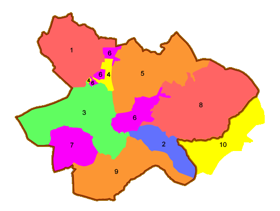
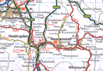
The upper map shown here is of the boundaries of the Haslingden Registration District and the Townships that it comprises of as applicable to the Censuses of 1841 to 1891. Their relationship to the towns and villages can be equated approximately with the lower map.

| Key to the Townships that are shown above | ||
| 1 = Acrington | 2 = Cowpe, Lenches, Newhallhey & Hall Carr | |||
| 3 = Haslingden | 4 = Henheads | 5 = Higher Booths | ||
| 6 = Lower Booths | 7 = Musbury | 8 = Newchurch | ||
| 9= Tottington Higher End | 10 = Brandwood | |||

The Haslingden Superintendant Registrar District is composed of the following Registration Districts and Townships
| Accrington Registrar | Townships of Old Accrington and New Accrington | ||
| Edenfield Registrar | Townships of Tottington Higher End & Musbury | ||
| Haslingden Registrar | Townships of Haslingden & Henheads | ||
| Newchurch Registrar | Township of Newchurch | ||
| Rossendale Registrar | Townships of Cowpe & Lenches, Newhallhey & Hall Carr, | ||
| Higher Booths and Lower Booths |
Click on the link below for
Downloadable detailed map of Haslingden Union
This map is in Adobe Acrobat PDF format. It is 2.24Mb in size and will print up to A3 page. When new window opens up go to the file menu and select Save As to save to Hard Drive or removable media (e.g.CD-ROM or USB Flash Drive)


