The Farms of Greenfold
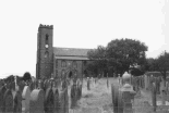
The paintings shown here are taken from a master painting by Ephraim Forrester of Ta Top Farm, Goodshaw, and was one of a series of paintings done by the artist to raise funds for St Mary & All Saints Church, Goodshaw and are reproduced here by kind permission of Ike Philipson of Laneside Farm, Loveclough.
The area known as Greenfold:
Approximately a quarter of a mile along Goodshaw Lane from Crawshawbooth, and directly behind Crawshawbooth Primary School is Folly Farm.
Behind Folly Farm on the right of the lane, and going east is a cart track which leads to the site of the old Hawthorne Mill. Past the old mill there is a narrow valley across which was placed a dam to create Greenfold Reservoir. When the reservoir was built in early 1860s the water authorities acquired all the farms which would cause drainoff in to the water course. These farms are, starting at the north west corner and along the north side: Greenfold Farm, Lower Edge, Higher Edge, Nodlock, Granny House, Peter Barn and then coming back along the south side: Higher Hugh Edge, Lower Hugh Edge and Nocliffe Eaves. After the reservoir was drained and the dam removed in the 1980s the land was returned to pastureland.
The Rossendale Free Press dated 21/06/1980 had an article on the removal of Lumb Valley Anglers fish stock prior to draining the reservoir for maintenance and inspection.
A Rossendale Free Press article dated 16/02/1985 stated that North West Water had abandoned plans to re-commission the reservoir, which had been drained several years earlier, after a structural survey estimated the work would cost £1.15m. Due to the small capacity of the reservoir and the low quality of the water it had been decided to remove the embankment at a cost of approximately £400,000 and the removal work would start in the summer (1985).
Facts and figures
The reservoir was built in the early 1860s and had a capacity of 15,000,000 cu ft of water(approx 93,000,000 gallons), had a catchment area of 16.5 acres and with average rainfall would be refilled 6 times per year. The estimated cost was £2,777.
The coal mine which was between Hugh Edge and Nodlock was Swinshaw Colliery which worked the same coal seam as Gambleside Colliery and operated from approximately 1800 until 1936. It was owned by George Hargreaves & Co as was Gambleside Mine.


